
Файл:4th-world-jamboree-map.jpg

Арыгінальны файл (1 055 × 767 кропак, аб’ём файла: 322 KB, тып MIME: image/jpeg)
Тлумачэнне
| Апісанне |
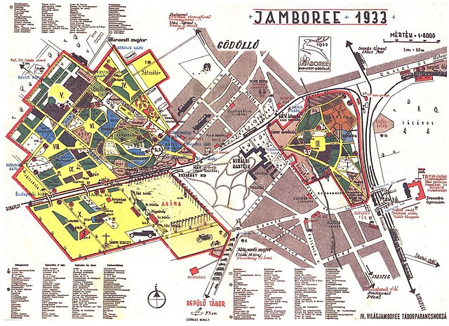
English: Location map and guide to the 4th World Jamboree held in Gödöllő, Hungary from August 2 to August 13, 1933. |
| Дата | |
| Крыніца | http://www.bibl.u-szeged.hu/ha/cserkesz/pic/index5.htm |
| Аўтар | Stoits György (?–1947) (?) |
| Іншыя версіі | https://maps.hungaricana.hu/hu/HTITerkeptar/35250/?list=eyJxdWVyeSI6ICJGT1JSPShodGkpIn0 |
| Camera location | | View this and other nearby images on: OpenStreetMap |
|---|
Ліцэнзіяванне
|
This work is in the public domain in its country of origin and other countries and areas where the copyright term is the author's life plus 70 years or fewer.
| |
| Гэты файл быў ідэнтыфікаваны як вольны ад вядомых абмежаванняў, згодна з законам аб аўтарскім праве, а таксама ад усіх сумежных правоў. | |
Гісторыя файла
Націснуць на даце з часам, каб паказаць файл, якім ён тады быў.
| Дата і час | Драбніца | Памеры | Удзельнік | Тлумачэнне | |
|---|---|---|---|---|---|
| актуальн. | 23:23, 6 лістапада 2008 | | 1 055 × 767 (322 KB) | Btphelps | {{Information |Description={{en|1=Location map and guide to the 4th World Jamboree held in Gödöllő, Hungary from August 2 to August 13, 1933.}} |Source=http://www.bibl.u-szeged.hu/ha/cserkesz/pic/index5.htm |Author=unknown |Date=1933 |Permission= |othe |
Выкарыстанне файла
Наступная 1 старонка выкарыстоўвае гэты файл:
Глабальнае выкарыстанне файла
Гэты файл выкарыстоўваецца ў наступных вікі:
- Выкарыстанне ў be-tarask.wikipedia.org
- Выкарыстанне ў cs.wikipedia.org
- Выкарыстанне ў de.wikipedia.org
- Выкарыстанне ў en.wikipedia.org
- Выкарыстанне ў fa.wikipedia.org
- Выкарыстанне ў hu.wikipedia.org
- Выкарыстанне ў pt.wikipedia.org
- Выкарыстанне ў ru.wikipedia.org